




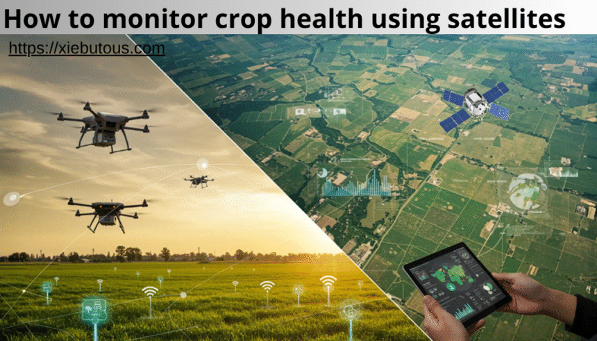
Farming has changed a lot in the last few years. Today, farmers do not need to walk through every field to check if crops are healthy. With the help of satellite technology, it is now possible to monitor large areas of farmland from space. This modern method is fast, cost-effective, and very accurate.
In this article, you will learn how to monitor crop health using satellites in a simple and practical way. The goal is to make this topic easy to understand, even if you are new to farming or technology. We will explore how satellite monitoring works, why it matters, what tools are used, and how farmers in the United States and around the world are using it to improve yields and reduce risks.
What Does Crop Health Mean
Crop health refers to how well plants are growing and whether they are free from stress. Healthy crops grow evenly, have strong leaves, and produce good yields. Unhealthy crops may suffer from problems such as lack of water, pests, diseases, or poor soil conditions.

Traditionally, farmers checked crop health by walking in the fields. While this still has value, it is time-consuming and not always accurate for large farms. Satellite monitoring helps solve this problem by giving a complete view of the field from above.
Also read:Can Root Canal Cause Health Problems A Complete Evidence Based Guide for Patients
Why Satellite Monitoring Is Important for Crop Health
Understanding how to monitor crop health using satellites is important because it helps farmers make better decisions. Instead of guessing, farmers can use real data to guide their actions.
Here are some key benefits:
Farmers can detect problems early before they spread
It saves time compared to manual field inspection
It reduces costs by using resources more efficiently
It improves crop yield and quality
It supports sustainable farming practices
In the United States, where farms can be very large, satellite monitoring is especially useful. It allows farmers to manage thousands of acres with better precision.
How Satellites Help Monitor Crop Health
Satellites orbit the Earth and capture images of farmland. These images are not like regular photos. They include data from different parts of the light spectrum, including visible and invisible light.
Plants reflect light in unique ways. Healthy plants reflect more near-infrared light and absorb more red light. Satellites use this information to measure plant health.
This is where vegetation indices come in. These are special formulas that turn satellite data into useful insights.
Understanding Vegetation Indices
Vegetation indices are key to learning how to monitor crop health using satellites. They help translate satellite images into meaningful data.
The most common index is NDVI, which stands for Normalized Difference Vegetation Index.
NDVI works by comparing the difference between near-infrared light and red light reflected by plants. Healthy plants have high NDVI values, while stressed plants have low values.
Other useful indices include:
EVI, which works better in areas with dense vegetation
NDWI, which helps measure water content in plants
GNDVI, which is useful for detecting nitrogen levels
These indices allow farmers to quickly see which areas of their fields need attention.
Step-by-Step Guide on How to Monitor Crop Health Using Satellites
Step 1: Choose a Satellite Data Provider
To begin, farmers need access to satellite data. There are many platforms that provide this data, both free and paid.
Free sources include government satellites that provide open data. Paid platforms offer more advanced features and higher resolution images.
When choosing a provider, consider:
Image resolution
Frequency of updates
Ease of use
Cost
Step 2: Access Satellite Images
Once you select a platform, you can view satellite images of your farm. These images are updated regularly, sometimes every few days.
You can zoom in to see specific areas of your field. Most platforms allow you to view historical data as well, which helps track changes over time.
Also read:Labarty: Meaning, Origins, Modern Use, and Why This Word Is Gaining Attention
Step 3: Apply Vegetation Indices
After accessing the images, the next step is to apply vegetation indices like NDVI. Many platforms do this automatically.
The result is a color-coded map. Typically:
Green shows healthy crops
Yellow shows moderate stress
Red shows severe stress
This visual representation makes it easy to understand crop health at a glance.
Step 4: Analyze Problem Areas
Look closely at areas that show stress. These zones may indicate problems such as:
Water shortage
Pest infestation
Disease
Soil issues
Instead of treating the entire field, farmers can focus only on these problem areas.
Step 5: Take Action
After identifying issues, farmers can take targeted action. For example:
Apply water only where needed
Use fertilizers in specific zones
Treat pests early before they spread
This approach is known as precision agriculture.
Step 6: Monitor Changes Over Time
One of the biggest advantages of satellite monitoring is the ability to track changes.
Farmers can compare images from different dates to see if their actions are working. This helps improve decision-making over time.
Types of Satellites Used in Agriculture
There are different types of satellites used to monitor crop health.
Optical satellites capture images using sunlight. They are widely used but cannot see through clouds.
Radar satellites use radio waves. They can capture data even in cloudy or rainy conditions.
Thermal satellites measure temperature. They help detect water stress in crops.
Combining data from different types of satellites provides a more complete picture of crop health.
Tools and Software for Satellite Crop Monitoring
There are many tools available that make it easy to learn how to monitor crop health using satellites.
These tools provide user-friendly dashboards and visual maps. Farmers can access them on computers or mobile devices.

Some tools also offer features like:
Field boundary mapping
Weather data integration
Soil analysis
Yield prediction
Choosing the right tool depends on your farm size, budget, and specific needs.
Real-World Applications in the United States
Farmers in the United States are using satellite monitoring in many ways.
Large farms use it to manage irrigation systems more efficiently. By knowing which areas need water, they can reduce waste and save costs.
Crop consultants use satellite data to advise farmers on fertilizer use. This helps improve soil health and reduce environmental impact.
Insurance companies use satellite monitoring to assess crop damage. This speeds up claims and improves accuracy.
Government agencies also use satellite data to track agricultural trends and ensure food security.
Advantages of Using Satellites for Crop Health Monitoring
There are many reasons why satellite monitoring is becoming popular.
It covers large areas quickly
It provides regular updates
It reduces manual labor
It supports data-driven decisions
It improves sustainability
These advantages make satellite technology a powerful tool for modern agriculture.
Challenges and Limitations
While satellite monitoring is very useful, it also has some limitations.
Also read:Spaietacle: A Complete Guide to Immersive Spaces, Emotional Design, and the Future of Experience
Cloud cover can block optical satellite images
High-resolution data may be expensive
It requires basic technical knowledge
Data interpretation can be challenging for beginners
However, as technology improves, these challenges are becoming less significant.
Future Trends in Satellite Crop Monitoring
The future of agriculture is closely linked to technology. Satellite monitoring will continue to evolve.
Artificial intelligence will play a bigger role in analyzing satellite data. This will make it easier to detect problems automatically.
Integration with drones and sensors will provide even more detailed insights.
Real-time monitoring will become more common, allowing farmers to respond instantly to changes.
These advancements will make it even easier to understand how to monitor crop health using satellites.
Best Practices for Farmers
To get the most out of satellite monitoring, follow these best practices.
Start with a simple platform and learn gradually
Combine satellite data with field observations
Use historical data to identify patterns
Focus on problem areas instead of the whole field
Keep learning and adapting to new tools
By following these steps, farmers can maximize the benefits of satellite technology.
Environmental Impact
Satellite monitoring also helps protect the environment.
It reduces the overuse of water and fertilizers
It lowers greenhouse gas emissions
It supports sustainable farming practices
This is important for the future of agriculture and the planet.
Cost Considerations
The cost of satellite monitoring varies.
Free data is available but may have lower resolution
Paid services offer better accuracy and features
Farmers should consider the return on investment. In many cases, the savings from improved efficiency outweigh the costs.
How Beginners Can Get Started
If you are new to this technology, start small.
Choose a simple platform
Monitor a small part of your farm
Learn how to read vegetation maps
Gradually expand your use
With time, you will become more confident in using satellite data.
Conclusion
Learning how to monitor crop health using satellites is no longer just for large farms or experts. It is now accessible to farmers of all sizes.
This technology provides valuable insights that help improve crop health, increase yields, and reduce costs. By using satellite data, farmers can make smarter decisions and manage their fields more effectively.
As technology continues to grow, satellite monitoring will become an essential part of modern farming. Those who adopt it early will have a strong advantage in the future.
FAQs
What is the easiest way to start learning how to monitor crop health using satellites?
The easiest way is to use a beginner-friendly platform that provides NDVI maps. Start by observing color changes in your fields and compare them over time.
Do I need technical skills to use satellite data?
Basic skills are enough to get started. Many tools are designed for farmers and are easy to use. Advanced analysis can be learned later.
How often are satellite images updated?
It depends on the satellite, but many platforms provide updates every few days. Some even offer daily images.
Can satellite monitoring replace field visits?
No, it should not fully replace field visits. It works best when combined with on-ground inspection.
Is satellite monitoring useful for small farms?
Yes, even small farms can benefit. It helps identify problems early and use resources more efficiently.
What crops can be monitored using satellites?
Most crops can be monitored, including corn, wheat, soybeans, and vegetables.